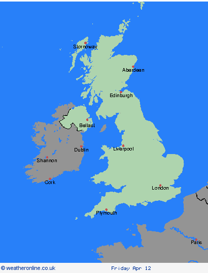
Avisos meteorológicos Archivo: lunes, 08/04/2024, 17:49 h CEST - Reino Unido


00:00-06:00

06:00-12:00

12:00-18:00

18:00-24:00


Severe Weather Warnings: Lluvia
issued by the Metoffice at
15:49, 08.04.2024
valid from
22:00, 08.04.2024
until
06:00, 09.04.2024
Región: Irlanda del Norte
Rain will spread north into the warning area before clearing away east through Tuesday morning. The rain will be heavy at times with accumulations of 25-30 mm expected quite widely and 40 mm falling in places, perhaps particularly near the coast and across the Mournes. What should I do? Check if your property could be at risk of flooding. If so, consider preparing a flood plan and an emergency flood kit. Give yourself the best chance of avoiding delays by checking road conditions if driving, or bus and train timetables, amending your travel plans if necessary. People cope better with power cuts when they have prepared for them in advance. It’s easy to do; consider gathering torches and batteries, a mobile phone power pack and other essential items. Be prepared for weather warnings to change quickly: when a weather warning is issued, the Met Office recommends staying up to date with the weather forecast in your area.
Chief ForecasterHeavy rain overnight Monday into Tuesday may lead to some transport disruption.
The public is advised to take extra care, further information and advice can be found here: http://www.metoffice.gov.uk/weather/uk/links.html
Severe Weather Warnings: Viento
issued by the Metoffice at
15:49, 08.04.2024
valid from
16:00, 08.04.2024
until
06:00, 09.04.2024
Región: Sudoeste de Inglaterra
A spell of strong winds will affect this region from late Monday afternoon, (when this swathe of gales reaches the Isles of Scilly), until Tuesday morning, when winds reduce along Bristol Channel coasts. Gusts will reach 45-55mph widely and 60-65mph along some exposed coasts, mainly in the south of the warning area. There is a possibility that a few locations in Cornwall, the Isles of Scilly and south Devon could see gusts to around 75mph. Large waves in combination with high tides may cause some impacts along coasts. What should I do? If you are on the coast, stay safe during stormy weather by being aware of large waves. Even from the shore large breaking waves can sweep you off your feet and out to sea. Take care if walking near cliffs; know your route and keep dogs on a lead. In an emergency, call 999 and ask for the Coastguard. Prepare to protect your property and people from injury. Check for loose items outside your home and plan how you could secure them. Items include; bins, garden furniture, trampolines, tents, sheds and fences. Give yourself the best chance of avoiding delays by checking road conditions if driving, or bus and train timetables, amending your travel plans if necessary. People cope better with power cuts when they have prepared for them in advance. It’s easy to do; consider gathering torches and batteries, a mobile phone power pack and other essential items. Be prepared for weather warnings to change quickly; the Met Office recommends staying up to date with the weather forecast in your area.
Chief ForecasterStrong winds and large coastal waves may cause some disruption.
The public is advised to take extra care, further information and advice can be found here: http://www.metoffice.gov.uk/weather/uk/links.html
Severe Weather Warnings: Viento
issued by the Metoffice at
15:49, 08.04.2024
valid from
21:00, 08.04.2024
until
09:00, 09.04.2024
Región: Sudoeste de Inglaterra
A spell of strong onshore winds will affect parts of the England Channel coastline overnight Monday and Tuesday morning. Gusts will reach 45-55 mph just inland from the coast and potentially 65 mph for exposed coastal spots. Later on Tuesday morning the wind will ease and the direction change to offshore. What should I do? If you are on the coast, stay safe during stormy weather by being aware of large waves. Even from the shore large breaking waves can sweep you off your feet and out to sea. Take care if walking near cliffs; know your route and keep dogs on a lead. In an emergency, call 999 and ask for the Coastguard. Be prepared for weather warnings to change quickly: when a weather warning is issued, the Met Office recommends staying up to date with the weather forecast in your area. Give yourself the best chance of avoiding delays by checking road conditions if driving, or bus and train timetables, amending your travel plans if necessary. People cope better with power cuts when they have prepared for them in advance. It’s easy to do; consider gathering torches and batteries, a mobile phone power pack and other essential items.
Chief ForecasterStrong winds are likely to bring hazardous coastal conditions and could cause some inland disruption.
The public is advised to take extra care, further information and advice can be found here: http://www.metoffice.gov.uk/weather/uk/links.html
Severe Weather Warnings: Viento
issued by the Metoffice at
15:49, 08.04.2024
valid from
21:00, 08.04.2024
until
09:00, 09.04.2024
Región: Londres & Sudeste de Inglaterra
A spell of strong onshore winds will affect parts of the England Channel coastline overnight Monday and Tuesday morning. Gusts will reach 45-55 mph just inland from the coast and potentially 65 mph for exposed coastal spots. Later on Tuesday morning the wind will ease and the direction change to offshore. What should I do? If you are on the coast, stay safe during stormy weather by being aware of large waves. Even from the shore large breaking waves can sweep you off your feet and out to sea. Take care if walking near cliffs; know your route and keep dogs on a lead. In an emergency, call 999 and ask for the Coastguard. Be prepared for weather warnings to change quickly: when a weather warning is issued, the Met Office recommends staying up to date with the weather forecast in your area. Give yourself the best chance of avoiding delays by checking road conditions if driving, or bus and train timetables, amending your travel plans if necessary. People cope better with power cuts when they have prepared for them in advance. It’s easy to do; consider gathering torches and batteries, a mobile phone power pack and other essential items.
Chief ForecasterStrong winds are likely to bring hazardous coastal conditions and could cause some inland disruption.
The public is advised to take extra care, further information and advice can be found here: http://www.metoffice.gov.uk/weather/uk/links.html
- Visión general


- Orcadas & Islas Shetland
- Highland & Eilean Siar
- Grampian
- Strathclyde
- Central, Tayside & Fife
- SW Scotland, Lothian Borders
- Irlanda del Norte
- Gales
- North West England
- North East England
- Yorkshire & Humber
- West Midlands
- Midlands del Este
- Este de Inglaterra
- Sudoeste de Inglaterra
- Londres & Sudeste de Inglaterra